Monday 11 April 2011
Wednesday 1 December 2010
Rothbury and the Carriage Drive
Going through Rothbury this is a nice short tootle with some good downhill sections and mixture of tracks. You could also join this route up with the Simonside route. If its summer you could even go for a dip in the Coquet at the Thrum.

1. Start at any of the car parks in Rothbury beside the river, either just out of Rothbury towards Thropton at Beggars Rig or the one over the bridge and to the right on the way to Rothbury. Either way head down the Coquet on the Northern bank towards the Thrum. The bridleway follows the river for about half a mile. You go past the rapids at Thrum mill before meeting the Rothbury road again. Turn left back to Rothbury then take the next right up the hill on the road to Cragside and Alnwick.
2. After one hill, going past the Cragside (There be dragons nothing to see :) ) walled garden, looping around the Cragside lakes and up the really steep hill to Alnwick you will reach a plateau Take the left hand turn here when you come to the forestry commission sign for Debdon.
3. Go through the trees and a gate to come out at the back of Rothbury moor. Keep to the left hand fork and follow the track down to a little cottage. Here take the right hand track along the edge of the wood. Follow this round and at the top the track goes through a set of double gates over a crossroads following the sign to Thropton. The track, called the "carriage drive", loops round the edge of Rothbury moor with fantastic views of Coquetdale and the Cheviots.
4. After just under a mile from the crossroads with Simonside in front of you there is a track to the right. If you want to take a short cut go down here and follow from 7, otherwise carry on along the main track. This goes above Rothbury down a short hill past a aerial and through a gate into some woods. After a short climb you traverse for a bit then snake down the track until you come to the Bridleway on your right.
5. The bridleway is a short but nice bit of singletrack that spits you out on the hillside road above Rothbury. Turn right and after under a mile, just before the road turns steeply down back toward Rothbury take the first left (Not the second to Pondercherry).
6. The lonnen goes up the hill again near some houses and back onto the moor. Climb up the track through the ancient defences and ditches of old Rothbury. Follow the rough stony track for about a mile to the top of Physic Lane. Hopefully you will recognise the spot from higher track you were on before.
7. Go through the gate and down Physic lane. You can't go wrong here if you stick to the track it goes through a few gates, new ones as well, bah it didn't happen in my day, down to the back of Thropton. Anyway on reaching the main road turn left back towards Rothbury.
8. After around a mile there is a track to your left to the Ladies Bridge (if you find yourself going up hill you've gone to far) Go down here, across the bridge and across the haugh to Newtown.
9. Here you join a proper road, go past the old Tosson mil and meet a T-junction. Take a left then a right up to Great Tosson. Have a look at the Tower if you want or continue on the road to the left up to Simonside.
10. After going up the hill and past the forestry car park (if you wanted to you could link this ride to the Simonside route here) you go down a short hill and over a cattle grid.
11. Here take the bridleway to the left straight after the cattle grid. Go through the newly planted wood for 200m then through a gate into a field. Go straight up the field following the fence and round an old quarry to a gate at some trees on you right. Go through this and ride along the grassy track east until you reach a small farm. Turn left and the track leads you around the front of the farm to the track back down to Rothbury. Keep on this and it brings you out at Whitton. Just after going passed the tower take a left then another left then right down to Rothbury. The tower called "Sharps Folly" was built as a "Job" creation scheme and used to be an observatory. On reaching the Coquet make your own way back.


Going through Rothbury this is a nice short tootle with some good downhill sections and mixture of tracks. You could also join this route up with the Simonside route. If its summer you could even go for a dip in the Coquet at the Thrum.
1. Start at any of the car parks in Rothbury beside the river, either just out of Rothbury towards Thropton at Beggars Rig or the one over the bridge and to the right on the way to Rothbury. Either way head down the Coquet on the Northern bank towards the Thrum. The bridleway follows the river for about half a mile. You go past the rapids at Thrum mill before meeting the Rothbury road again. Turn left back to Rothbury then take the next right up the hill on the road to Cragside and Alnwick.
2. After one hill, going past the Cragside (There be dragons nothing to see :) ) walled garden, looping around the Cragside lakes and up the really steep hill to Alnwick you will reach a plateau Take the left hand turn here when you come to the forestry commission sign for Debdon.
3. Go through the trees and a gate to come out at the back of Rothbury moor. Keep to the left hand fork and follow the track down to a little cottage. Here take the right hand track along the edge of the wood. Follow this round and at the top the track goes through a set of double gates over a crossroads following the sign to Thropton. The track, called the "carriage drive", loops round the edge of Rothbury moor with fantastic views of Coquetdale and the Cheviots.
4. After just under a mile from the crossroads with Simonside in front of you there is a track to the right. If you want to take a short cut go down here and follow from 7, otherwise carry on along the main track. This goes above Rothbury down a short hill past a aerial and through a gate into some woods. After a short climb you traverse for a bit then snake down the track until you come to the Bridleway on your right.
5. The bridleway is a short but nice bit of singletrack that spits you out on the hillside road above Rothbury. Turn right and after under a mile, just before the road turns steeply down back toward Rothbury take the first left (Not the second to Pondercherry).
6. The lonnen goes up the hill again near some houses and back onto the moor. Climb up the track through the ancient defences and ditches of old Rothbury. Follow the rough stony track for about a mile to the top of Physic Lane. Hopefully you will recognise the spot from higher track you were on before.
7. Go through the gate and down Physic lane. You can't go wrong here if you stick to the track it goes through a few gates, new ones as well, bah it didn't happen in my day, down to the back of Thropton. Anyway on reaching the main road turn left back towards Rothbury.
8. After around a mile there is a track to your left to the Ladies Bridge (if you find yourself going up hill you've gone to far) Go down here, across the bridge and across the haugh to Newtown.
9. Here you join a proper road, go past the old Tosson mil and meet a T-junction. Take a left then a right up to Great Tosson. Have a look at the Tower if you want or continue on the road to the left up to Simonside.
10. After going up the hill and past the forestry car park (if you wanted to you could link this ride to the Simonside route here) you go down a short hill and over a cattle grid.
11. Here take the bridleway to the left straight after the cattle grid. Go through the newly planted wood for 200m then through a gate into a field. Go straight up the field following the fence and round an old quarry to a gate at some trees on you right. Go through this and ride along the grassy track east until you reach a small farm. Turn left and the track leads you around the front of the farm to the track back down to Rothbury. Keep on this and it brings you out at Whitton. Just after going passed the tower take a left then another left then right down to Rothbury. The tower called "Sharps Folly" was built as a "Job" creation scheme and used to be an observatory. On reaching the Coquet make your own way back.
Saturday 20 November 2010
Usway and Kidland
One of my favourite routes that is nearly 100% off road on a variety of types of track and all in a stunning landscape.

1. Start off at National park car park in Alwinton,. From here go a short distance back on the road to Harbottle then turn left to Clennell just before the bridge over the Alwin. Go up the Alwin haugh past Clennell to your right following the track as the hills get bigger and higher. After a few miles and a few bridges you get to Kidland Forest. Up a little hill, ignoring the track to Kidlandlee to your left, and down through the forest. You shortly come to a clearing in the forest. Take the track to your left over a ford.
2. This track goes further into one of the steep valleys of Kidland. Keep on the main track up to Whiteburnshank. Take care of the fords as they can get a bit slippery and deep especially when the river is in spate. Though since they have done up Whiteburnshank as a bunk house I think they have been made better as they seemed less challenging than they were used to be. The track up to Clennell Street past Whiteburnshank is really steep, well done if you can get to the top without stopping. Ignore the first track on your right you come to at the top but keep going on to Clennell street, turn right and down the hill for about a mile. There is a track here to your left, if you want you can use this as a shortcut down to Fairhaugh if your knackered but you would miss the best bit of the ride then. The main route continues straight on and turns into a rutted grassy tack which soon meets a wicket opening out on to the hills.
3. Clennel Street traverses the edge of Yarnspath Law here dropping steeply to the Usway. They have improved the track here firming up the clarty bits which means that you can go pretty fast. At the bottom cross over the bridge, through the wicket to your right and loop round to your left. After going through another wicket turn right turn right and cross over the road to Uswayford (Use-e-ford), joining the Clennel Street track to the border ridge. Most of it is ridable, but there are some loose and clarty sections. When you have reached the gate you are nearly at the top and Scotland, fantastic view, with Scotland looking a lot less forbidding than Northumberland. Over into Scotland is Cocklawfoot (Cock'lfoot), an excellent track that deserves a look.
4. Now turn left up to Windy Gyle the first bit is a footpath so walking may be in order across the stone slabs. Halfway up it turns into a bridleway, (where were those horses going and why didn't they go all the way to Clennell Street?) It also gets boggy and steep. This bit is much better in a dry summer or more frequently a cold frozen winter, more grip and less erosion but they have paved most of the worst bits. The top of Windy Gyle was a meeting point for border officials at the time of the reivers and the cairn at the top is named after a Lord Russell who was murdered at one such meeting. No ghosts though and this strangely enough is the most likely place to meet anyone on the whole route.
5. Now for a big downhill. South through the muddy wicket, which they were paving when I was there last week, and back into Northumberland following the track as it curves to the left and then steeply down. Hold on, go as fast as you dare but mind you don't fettle yourself by clipping one of the ruts. When the track eases off a bit follow the farm track to the right directly down the rig to Trows. It turns into a smooth grassy track that only slows down when it is wet (Mind the cows and calves though). Eventually it turns into a stony farm track, with a few gates so beware. After 2.5 miles you get to the bottom and a ford and the small farm at Trows.
6. Turn left up the red gravel track to your left and eventually you will reach the point where you climbed up to the border ridge from the Usway. Turn right off the road and south through the gate (Not the wicket on your left which you came through before). You will see a track going up the Fairhaugh ridge, don't go on this one but take the excellent little single track to the left that scoots round the ridge joining up with it again as it enters the forest. Up a slight hill, ignoring the track to your left go straight down the steep rutted track to Fairhaugh. Either cross the burn using the bridge on the left or the ford to your right.
7. Go round the farm and then take the singletrack bridleway to your right following the burn, whooshing through the forest on a great little, sometimes precarious, trail all the way down the haugh to BattleSheil. Follow the bridleway round the back of the farm and drop on to the track to Shillmoor. The farm was run by my great grandad and my granny used to tell me she used to get here on a pony and trap. On reaching the Coquet at Shillmoor turn left in front of the cattle sheds and over a dry ford. Leave the farm track on the bridleway is a ace little single track that follows the wall to your right.
8. This goes straight on and after about a mile goes over the Snout on a steep grassy track called Path Peth. I managed to climb to the top on the last attempt only to come off in the really clarty and stinky bog at the top so you have been warned! It is all down hill from here down a good track to the Alwinton road. Turn left on to the road and on reaching Alwinton have a well deserved pint at the Rose and Thistle.


Up to the border Ridge


1. Start off at National park car park in Alwinton,. From here go a short distance back on the road to Harbottle then turn left to Clennell just before the bridge over the Alwin. Go up the Alwin haugh past Clennell to your right following the track as the hills get bigger and higher. After a few miles and a few bridges you get to Kidland Forest. Up a little hill, ignoring the track to Kidlandlee to your left, and down through the forest. You shortly come to a clearing in the forest. Take the track to your left over a ford.
2. This track goes further into one of the steep valleys of Kidland. Keep on the main track up to Whiteburnshank. Take care of the fords as they can get a bit slippery and deep especially when the river is in spate. Though since they have done up Whiteburnshank as a bunk house I think they have been made better as they seemed less challenging than they were used to be. The track up to Clennell Street past Whiteburnshank is really steep, well done if you can get to the top without stopping. Ignore the first track on your right you come to at the top but keep going on to Clennell street, turn right and down the hill for about a mile. There is a track here to your left, if you want you can use this as a shortcut down to Fairhaugh if your knackered but you would miss the best bit of the ride then. The main route continues straight on and turns into a rutted grassy tack which soon meets a wicket opening out on to the hills.
3. Clennel Street traverses the edge of Yarnspath Law here dropping steeply to the Usway. They have improved the track here firming up the clarty bits which means that you can go pretty fast. At the bottom cross over the bridge, through the wicket to your right and loop round to your left. After going through another wicket turn right turn right and cross over the road to Uswayford (Use-e-ford), joining the Clennel Street track to the border ridge. Most of it is ridable, but there are some loose and clarty sections. When you have reached the gate you are nearly at the top and Scotland, fantastic view, with Scotland looking a lot less forbidding than Northumberland. Over into Scotland is Cocklawfoot (Cock'lfoot), an excellent track that deserves a look.
4. Now turn left up to Windy Gyle the first bit is a footpath so walking may be in order across the stone slabs. Halfway up it turns into a bridleway, (where were those horses going and why didn't they go all the way to Clennell Street?) It also gets boggy and steep. This bit is much better in a dry summer or more frequently a cold frozen winter, more grip and less erosion but they have paved most of the worst bits. The top of Windy Gyle was a meeting point for border officials at the time of the reivers and the cairn at the top is named after a Lord Russell who was murdered at one such meeting. No ghosts though and this strangely enough is the most likely place to meet anyone on the whole route.
5. Now for a big downhill. South through the muddy wicket, which they were paving when I was there last week, and back into Northumberland following the track as it curves to the left and then steeply down. Hold on, go as fast as you dare but mind you don't fettle yourself by clipping one of the ruts. When the track eases off a bit follow the farm track to the right directly down the rig to Trows. It turns into a smooth grassy track that only slows down when it is wet (Mind the cows and calves though). Eventually it turns into a stony farm track, with a few gates so beware. After 2.5 miles you get to the bottom and a ford and the small farm at Trows.
6. Turn left up the red gravel track to your left and eventually you will reach the point where you climbed up to the border ridge from the Usway. Turn right off the road and south through the gate (Not the wicket on your left which you came through before). You will see a track going up the Fairhaugh ridge, don't go on this one but take the excellent little single track to the left that scoots round the ridge joining up with it again as it enters the forest. Up a slight hill, ignoring the track to your left go straight down the steep rutted track to Fairhaugh. Either cross the burn using the bridge on the left or the ford to your right.
7. Go round the farm and then take the singletrack bridleway to your right following the burn, whooshing through the forest on a great little, sometimes precarious, trail all the way down the haugh to BattleSheil. Follow the bridleway round the back of the farm and drop on to the track to Shillmoor. The farm was run by my great grandad and my granny used to tell me she used to get here on a pony and trap. On reaching the Coquet at Shillmoor turn left in front of the cattle sheds and over a dry ford. Leave the farm track on the bridleway is a ace little single track that follows the wall to your right.
8. This goes straight on and after about a mile goes over the Snout on a steep grassy track called Path Peth. I managed to climb to the top on the last attempt only to come off in the really clarty and stinky bog at the top so you have been warned! It is all down hill from here down a good track to the Alwinton road. Turn left on to the road and on reaching Alwinton have a well deserved pint at the Rose and Thistle.
Up to the border Ridge
Monday 27 October 2008
Simonside route

Coquet valley from the top
Near to Rothbury this route has long descents, fast forestry roads and fantastic views of the Cheviots, Coquetdale and the coast.The best bit is the Hepplewhitefield descent which is one of my favourite downhills in the valley. It is a lot easier than when I first came down it on a Raleigh with no suspension when I was 14. You can link it with the Rothbury route for a longer ride. Just mind out you don't get into any trouble with the native dwarves The Duergar.

Route Map
The map is not completely right as I have changed the route slightly since I drew it.
1. Start at the Simonside Forestry car park. Go go up the hill passed the barrier. Ignore the track downhill to your left as you loop round but on meeting the next junction take the right hand fork a ride down the track with the antenna on your right, Follow the forestry road down the hill, take the next left up the hill and through the barrier. There is a path to your left here to an interesting rock formation called little church rock but this is not a very good track for bikes. Don't take this path but continue on the forestry track. Follow the track straight as it descends and then starts to climb again. It get bit more interesting here as the track turns into a singletrack climb starting a bit wet but then turning into a rocky trail that climbs up through the old part of the beach forest on Simonside. You come to a little cairn and the the path swings to the left and then right and left again. Please mail me if you can climb all the way up here. You would need some serious trials skills to get up the last bit! After the rocks the you come out of the forest and there is a nice rocky climb up to the base of the base of the Simonside plateau.Cycle left towards Simonside but then turn right onto the forestry track into the forest. Here you might want to cycle left for about 100m and stop and take in the fantastic view from the top. You get a brilliant view of the Coquet valley, the Cheviots, the coast and heather moors above Rothbury and Thrunton.
2. After having a break at the top turn south into the forest following the main track. Don't take any of the tracks to the left and after about 1 and a half miles you should see a white farmhouse, Chatners, in a clearing to the off right.
3. Take the left hand fork of the road (when the other goes up the hill to Chatners) then the next right soon after to go up a slight hill. After two thirds of a mile take the right up the hill and follow this track round. Eventually you start going down again, past a small quarry on the left a hair pin bend and then just over half a mile after a straight section take the track that veers off the forestry road to the left on a steep corner to the right.
4. Go through the gate and follow the obvious track down to Hepple Whitefield. This gets washed out so there might be some nasty big holes, BEWARE. After going through a gate off the heather moor follow the grassy track that crosses over the field diagonally to the right past the sheep to a red track. Follow this down the hill, past the hall and back to the road. Woohoo. Hope you did not get any punctures on the way down.
5. On meeting the road turn right and down the hill towards Bickerton. At Bickerton take the bridleway to the left across the haugh, past the Caistron gravel works and bird sanctuary through a few gates and join a track that leads you back to Ryehill. Just as you come off the haugh up to Ryehill there is an old World War Two Pill box.There is a whole line of them right up the Coquet. May be they thought it might be a good place to land planes. At Ryehill farm ride straight on and then take the left up to Great Tosson. You can have a look at the old lime kilns on the way up or take a look at the old peel tower at Tosson. Peel towers were fortified towers to defend against the border reivers.

Coquet valley from the top

Sea from the top

Snow at the top

Snow in the forest

Snow in the forest

Chatners

Snow in the forest
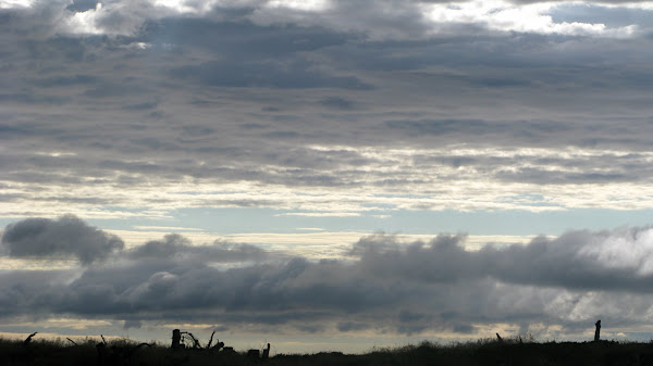
Clouds


Snow on Hepplewhitefield

Hepplewhitefield descent

Hepplewhitefield Descent

Wild flowers on the haugh at Caistron

Sculpture for the cows on the Coquet haugh


Subscribe to:
Posts (Atom)